Safety and Landmines in Rural Herzegovina
Are there still landmines in Herzegovina, and should I worry about them as a tourist?
About 1.6% of Bosnia and Herzegovina's territory is still suspected of containing mines and unexploded ordnance left from the 1992-1995 war, almost entirely in remote forest and mountain terrain. Towns, paved roads, and marked, frequented hiking trails are cleared and safe; the risk only becomes real if you leave the marked path in isolated rural areas.
What Every Hiker Should Know Before Leaving the Trail
Herzegovina’s countryside is one of its biggest draws: white limestone ridges, river canyons, and mountain plateaus that feel a world away from the old bazaars of Mostar. It is also, in scattered pockets, land that has not been fully cleared since the 1992-1995 war. That single fact deserves a clear-eyed page of its own, because the two most common reactions to it are both wrong. Some visitors dismiss it entirely, assuming it is ancient history with no bearing on a modern hiking trip. Others overcorrect and treat the whole region as a minefield, which makes them nervous about places that carry no risk at all. Neither reaction is accurate, and neither is useful when you are planning where to walk.
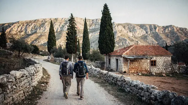
The real picture is narrow and specific: a small share of the country’s rural, forested, and mountainous terrain remains suspected of containing mines and unexploded ordnance. Everywhere you are actually likely to go as a tourist in and around Mostar — the old town, the riverside promenades, the paved roads to Blagaj, Počitelj, or Kravice, and every marked, regularly walked trail covered on this site — sits outside that suspected ground. The caution only applies once you step off a marked path into isolated rural terrain that nobody has recently checked.
The 1.6% Figure, and Where It Actually Applies
Roughly 1.6% of the territory of Bosnia and Herzegovina remains classified as suspected hazardous area — land that may still contain mines or unexploded ordnance left over from the 1992-1995 war. That figure is national, not local to Herzegovina specifically, but the pattern it describes holds everywhere in the country: the suspected ground is rural, and it clusters in forest, scrubland, abandoned farmland, and mountainside that saw fighting or sat along old front lines, then went unused and unchecked for years afterward.
It is worth being precise about what that 1.6% is not. It is not spread evenly across the map like a general hazard blanketing the countryside. It is not found in towns, villages, or anywhere with regular foot or vehicle traffic. It is not on the paved highway network, and it is not on the maintained hiking trails that guidebooks, park authorities, and tour operators actually route people along.
Three decades of systematic demining work have cleared the overwhelming majority of the country’s land, including virtually everywhere a visitor to Mostar would naturally go. What remains is concentrated in exactly the terrain that is hardest and slowest to verify: remote forest, steep mountainside, and farmland that was abandoned during and after the war and never fully reclaimed.
Where There Is No Cause for Concern
Every attraction described elsewhere on this site — the Stari Most and the old town, the bazaar at Kujundžiluk, the tekija at Blagaj, the citadel at Počitelj, the falls at Kravice, the vineyards around Čitluk, the necropolis at Radimlja, the monastery at Trebinje — sits on cleared, developed, or heavily trafficked ground. So does every road you would drive between them, and every marked trail that a park authority or a licensed operator maintains and promotes for public use. Booked activities matter here too: a canyoning run, a rafting trip on the Neretva, or a via ferrata route operated by a licensed guide company uses vetted terrain that the operator returns to constantly, not ground anyone is exploring for the first time.
The practical takeaway is simple: nothing about this topic should change your plans for visiting the sights, walking through towns, or joining a guided activity such as a via ferrata outing at Blagaj. It becomes relevant only in one specific situation, which is the subject of the next section.
Where Caution Is Real: Off the Marked Path in Remote Terrain
The genuine caution zone is narrow: unmarked or overgrown ground, away from villages and paved roads, mainly in upland and forested areas. Herzegovina’s mountain interior — ranges such as Prenj and Čvrsnica, and the high plateau around Blidinje — carries some of this legacy, simply because that terrain saw less traffic and slower demining work than the lowland towns and valleys. The same caution applies, in smaller pockets, to overgrown farmland and forest edges elsewhere in the countryside that sat near old front lines.
None of this means those mountains are off-limits. It means the difference between a marked, maintained trail and an improvised route off it is the difference between safe ground and unverified ground. A trail that is signed, appears on a park map, and gets walked regularly by hikers and guides has been checked and is treated as clear. A shortcut across a field, a scramble up an unmarked slope to reach a better view, or a detour into treeline to escape the sun carries a risk that simply is not present on the path itself.
The Rules That Actually Matter
The guidance here is short enough to remember in full, and it covers every situation you are likely to face on a hike, a canyoning trip, or any outing that takes you off asphalt:
- Stay on marked, maintained trails. If a route is not signed or does not appear on a trail map, treat it as unverified rather than assuming it is fine because it looks well-trodden.
- Never cut across open country in isolated rural areas — no shortcuts through fields, no bushwhacking through forest, no wandering off to chase a view or a photo, however tempting the terrain looks.
- Treat any warning signage as final. Red-and-white markers, a red skull-and-crossbones symbol, or even a hand-painted board or a strip of tape between posts all mean the same thing: turn back, do not investigate further.
- If you see an object that looks like it could be ordnance — rusted metal, an odd shape half-buried in leaf litter, anything that does not belong — do not touch it, move it, or step closer for a photo. Note roughly where it is, back away along the route you came in on, and report it once you are somewhere with a signal or a person to tell: your accommodation, a park ranger, or the local police.
- When in doubt about a specific route, ask locally before you set out — accommodation hosts, park visitor centers, and licensed guides all know which trails are actively maintained and which have fallen out of use.
Reading the Warning Signs
Signage in remote areas is not always the crisp international symbol you might expect. In addition to the standard red skull-and-crossbones marker, you may come across simpler warnings: a strip of red-and-white tape strung between trees or posts, a hand-lettered board nailed to a tree, or a rusted metal sign whose paint has faded but whose shape is still recognizable. Age or informality does not reduce how seriously to take it. Any such marker at the edge of a field, a forest track, or an abandoned building is a boundary, not a suggestion — the correct response is always to turn around and continue on a route you know is cleared.
If You Find Something Suspicious
Herzegovina’s countryside does turn up the occasional overlooked reminder of the war — a piece of old ordnance surfaced by erosion, farm work, or simply time. If you come across anything that looks like it could be unexploded material, the response is the same regardless of how confident or uncertain you are about what it actually is:
- Do not touch it, move it, kick it, or attempt to examine it closely.
- Do not take a photo by getting close — step back to a safe distance first.
- Note the approximate location as best you can (a nearby landmark, a GPS pin from your phone if you have signal).
- Leave the area by retracing the route you arrived on, rather than continuing forward or trying a different way out.
- Report it as soon as you can — to your accommodation host, a nearby park ranger or visitor center, or the local police. Bosnia and Herzegovina maintains a dedicated demining authority that responds to exactly these reports, and reporting costs you nothing beyond a short conversation.
This is a low-probability scenario for the kind of trip most visitors take, but it is worth knowing the steps in advance rather than improvising them on the spot.
Guided Trips Versus Independent Exploration
For a walk through Mostar’s old town, a stroll around Blagaj, or any trail that is clearly marked and regularly used, going independently carries no meaningful difference from going with a guide as far as this topic is concerned. The calculation changes once you are heading into less-trafficked mountain terrain, planning a longer hike with multiple route options, or considering any kind of off-trail detour.
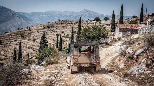
A local guide brings something a map cannot: current knowledge of which trails are actively maintained this season, which paths have quietly fallen out of use, and how conditions shift after heavy rain or winter snowmelt can move markers or wash out sections of trail. For ambitious mountain days around Blidinje, Prenj, or Čvrsnica in particular, a guide who walks that specific terrain regularly is worth more than any general reassurance — the same reasoning that makes a guided jeep safari through canyon terrain a safer way to see remote ground than improvising a route alone.
A Brief History: Why This Legacy Still Exists
The 1992-1995 war left large parts of Bosnia and Herzegovina’s countryside seeded with mines and unexploded ordnance, laid along front lines, around former military positions, and across farmland that was fought over or abandoned during the fighting. In the decades since, the country has run one of the more sustained demining programs in the world, methodically clearing land parcel by parcel and verifying it before releasing it back for normal use. That is why the overwhelming majority of the country — including every town, every paved road, and every established trail a visitor would use — is fully cleared today.
What remains is not evidence that the work has stalled; it reflects how genuinely difficult it is to fully verify remote forest and steep mountainside, where dense vegetation, difficult access, and shifting ground all slow the process compared to open farmland or built-up areas. The remaining 1.6% is the hardest-to-clear fraction of what was once a far larger problem, concentrated in exactly the kind of terrain — remote, wooded, mountainous — that takes longest to finish.
Practical Checklist Before Any Hike or Off-Trail Outing
- Confirm your planned route is a marked, maintained trail before you set out, whether through a park map, a guide, or your accommodation host.
- Pack for the terrain and season rather than improvising a shortcut partway through — carrying enough water and daylight buffer removes the temptation to cut across unfamiliar ground when you are tired or running late.
- Keep to the path even when a view, a photo, or a shortcut looks appealing just off it.
- Save the contact details for your accommodation and, if you’re heading deep into the mountains, the nearest park visitor center, before you lose signal.
- If travelling with a group, agree in advance that everyone stays on the marked route together, rather than splitting off to explore independently.
Safety and Landmines in Rural Herzegovina: Frequently Asked Questions
Is Mostar itself, or the Stari Most and other main sights, affected by landmines?
No. The old town, the bridge, and every established attraction covered on this site sit on cleared, built-up, or heavily walked ground. The suspected areas are rural, forested, and mountainous, not urban or touristic.
Which parts of Herzegovina still carry a real risk?
Unmarked or overgrown terrain away from villages and roads, mainly in upland areas such as Blidinje, Prenj, and Čvrsnica, plus scattered pockets of forest and abandoned farmland elsewhere in the countryside that saw fighting during the 1992-1995 war.
Can I hike in Blidinje Nature Park or on Mount Prenj safely?
Yes, as long as you stay on marked, maintained trails and use a route that is signed and regularly walked. The danger is not the mountains themselves but wandering off-trail across unchecked ground.
What do the warning signs look like?
Look for red-and-white or red skull-and-crossbones signage, sometimes just a hand-painted board or tape strung between posts. Any such marker, however informal it looks, means turn back rather than investigate.
What should I do if I see a suspicious object in a field or forest?
Do not touch it, move it, or take a photo up close. Note the general location, back away the way you came, and report it to your accommodation, a park ranger, or the local police. Bosnia and Herzegovina has a dedicated demining authority that responds to these reports.
Is it safer to hike with a guide than on my own?
For anything beyond a well-marked, popular trail, yes. Local guides know which routes are cleared and maintained, which shortcuts to avoid, and how conditions change after storms or snowmelt shift ground markers.
Does this affect canyoning, rafting, or via ferrata routes near Mostar?
Established commercial routes run by licensed operators use vetted, regularly used terrain. The caution here applies to improvising your own route off the beaten path, not to booked activities on known circuits.
Why does this legacy still exist more than thirty years after the war?
Demining rural terrain, especially forest and mountainside, is slow and expensive work. Bosnia and Herzegovina has cleared the vast majority of its land since the 1992-1995 war, but the remaining 1.6% is concentrated in exactly the kind of remote ground that takes longest to fully verify.
None of this should overshadow the rest of your trip.
Read alongside a hiking checklist for Herzegovina, a guide to hiking Blidinje and Mount Prenj, the practicalities of via ferrata near Mostar, canyoning in the Neretva gorges, rafting on the Neretva, kayaking on the Neretva and Buna, ATV and buggy routes in Herzegovina, off-road jeep safaris, cycling around Mostar and the Neretva valley, the Ćiro Trail by bike, and trails through the Neretva canyon at Jablanica.
For context on the region’s two very different conflicts, see understanding the 1992-1995 war in Mostar and the broader practical guide to war-memory tourism in Herzegovina. None of this applies to the well-trodden ground at Kravice, Blagaj, Počitelj, or the Stari Most itself — or to any route listed under hiking and nature activities on this site. For more general planning, browse the full travel tips section.
Wine tasting and winery tours on GetYourGuide
Verified deep-linked GetYourGuide tours. Book through these links and we earn a small commission at no cost to you.
GetYourGuide does not provide a product photo for this activity — the image shows the meeting point, photographed by us.