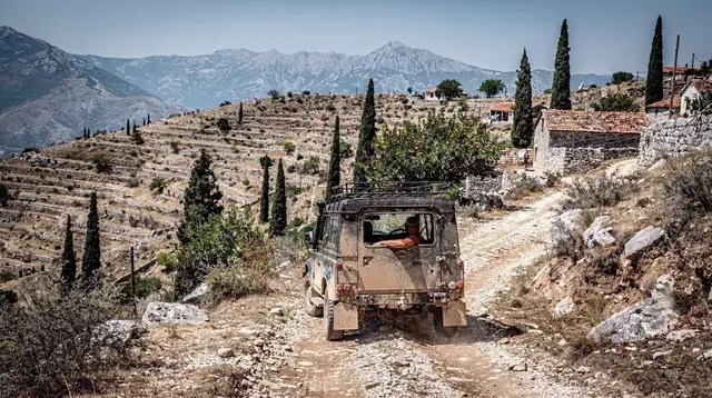
Hiking the Neretva Canyon Around Jablanica
Are there hiking trails around Jablanica besides the 1943 battle museum?
Yes. Marked valley trails follow the Neretva around Grabovica, Diva Grabovica and Boračko Lake, and quieter paths thread the villages of Drežnica. They stay lower and easier than Blidinje or Mount Prenj, and hikers should keep to marked paths because of residual landmine risk in unmarked rural areas.
Why Jablanica Is the Easy Way Into the Neretva Canyon
Most visitors reach Jablanica for one reason: the museum built around the wrecked railway bridge from the 1943 Battle of the Neretva, a set-piece of the Yugoslav Partisan war rather than the 1992-1995 conflict — the two are easy to confuse, and this site keeps them separate in the guide to telling the two wars apart. What most visitors miss is that the town also sits at the mouth of a genuinely good stretch of canyon walking, spread across the shores of the reservoir known as Boračko Lake, the side valley of Grabovica and Diva Grabovica, and the quieter villages of Drežnica just south along the Mostar road.
None of this is high-mountain hiking. That is the point. If Blidinje and Mount Prenj further north mean a proper alpine day — altitude, exposure, a longer drive and a shorter season — the trails around Jablanica are valley-level walks that a reasonably fit visitor can do in trainers with water and a hat, fitted around a museum visit, a paddle on the river, or a stop on the way between Mostar and Sarajevo.
Getting There and Getting Oriented
Jablanica lies on the Mostar-Sarajevo road and railway, roughly halfway between the two cities and a comfortable day-trip distance from either. Trains and buses both stop in town, which makes this one of the few canyon walks on this site that does not assume a rental car — see the guide to the Mostar-Sarajevo train if you are stitching this into a longer route rather than a Herzegovina loop by road.
From the town centre, the lake shore and the Grabovica valley trailheads are a short taxi ride or a walkable stretch along the water. Drežnica requires either your own transport or a taxi, since its trails start a little further out along a side road that peels off from the main Mostar-Jablanica highway. None of the walking described here needs technical gear, but a map or offline GPS track is worth having, since waymarking is inconsistent between the lakeside paths (well signed) and the smaller village routes around Drežnica (thinner, and easy to lose in an orchard or a lane).
Walking Above Boračko Lake
Boračko Lake is a glacial-looking body of water tucked into the hills near Konjic, a short drive north of Jablanica proper, and it is the easiest of the three areas covered here. A path circles a good part of the shoreline, mostly flat, shaded in places by pine, with the water close enough on one side that swimming breaks are part of the appeal in summer. It is a good half-day option for families or for anyone easing into the region before a harder day elsewhere, and it pairs naturally with a stop at the Konjic-area sights — the old Ottoman bridge and Tito’s bunker — on the same outing.
Because the lake sits at higher elevation than the Neretva itself, mornings and evenings here run noticeably cooler than down in Mostar, which is worth knowing if you are trying to time a walk around the worst of a Herzegovina heatwave.
The Grabovica and Diva Grabovica Trail
South of Jablanica, where the Neretva narrows into a proper gorge, a side valley opens up at Grabovica and climbs into a nature reserve known as Diva Grabovica — limestone walls, a seasonal stream, and a trail that gains height gradually rather than all at once. This is the closest thing in this guide to a real canyon hike: expect loose stone underfoot in places, some scrambling where the path crosses streambed sections, and a noticeably longer day than the lakeside loop at Boračko.
Treat Diva Grabovica as a moderate outing rather than a casual stroll, and start early enough to be back at the road before the afternoon heat sets in — the valley holds warmth the way most of Herzegovina’s limestone terrain does. The reward is a canyon that feels genuinely remote for how close it sits to a main road, with rock walls closing in overhead and almost none of the coach traffic that fills Kravice or the old town in Mostar.
Drežnica: Villages, Springs and Quiet Paths
Drežnica is a scatter of villages along its own tributary valley, a short drive south of Jablanica and roughly on the way toward Mostar. The walking here is different in character from the canyon trails above it: gentler grades, more farmland and orchard, old stone watermills along the stream, and small natural pools that locals use for a summer dip well away from any tour bus. Paths link one hamlet to the next rather than climbing to a single viewpoint, so this is a good area for an unhurried few hours rather than a summit-style objective.
It is also, precisely because it is rural and thinly visited, the area where the caution below matters most.
The One Rule That Matters: Stay on the Marked Path
Herzegovina’s rural, wooded and mountain terrain still carries a residual landmine risk left over from the 1992-1995 war — roughly 1.6% of the country’s total territory remains classified as suspect, concentrated in exactly this kind of countryside rather than in towns, on paved roads, or on established, frequently walked trails. The lakeside path at Boračko, the marked route into Diva Grabovica, and the linking paths around Drežnica are all safe, used trails. The risk appears only if you leave them.
In practice this means a short, unambitious set of habits: stay on the path that is visibly worn or waymarked, never cut across a field, orchard edge, or patch of forest to shortcut a loop or reach a better photo angle, and if you ever see a red sign with a skull and crossbones, treat it as absolute — do not approach it, do not photograph it up close, and do not assume it is old or decommissioned.
None of this should make the walking feel fraught; it simply means resisting the very normal hiking instinct to wander off a trail toward a nice-looking rock or a shortcut home. The rural safety and landmine guide covers this in more depth if you are planning several days of walking rather than one outing, and the Herzegovina hiking checklist is worth a look before you leave Mostar.
| Area | Character | Typical length | Difficulty |
|---|---|---|---|
| Boračko Lake shoreline | Flat lakeside path, some shade, swim spots | Half day | Easy |
| Grabovica / Diva Grabovica | Canyon valley, loose stone, some scrambling | Full day | Moderate |
| Drežnica villages | Farmland, watermills, quiet lanes | Half day | Easy |
What to Carry and How Fit You Need to Be
None of these routes demand mountaineering fitness, but the Herzegovina sun does most of the work of making a walk harder than it looks on paper. Bring more water than feels necessary, especially for Diva Grabovica, where shade is patchy and the canyon floor reflects heat back up. Proper footwear with grip matters more than a fashionable trail shoe once the path crosses loose limestone scree, which happens on most routes here sooner or later.
A hat and sun protection are not optional in the June-to-September window, and a basic first-aid kit is sensible for anywhere as thinly visited as Drežnica, where you cannot count on passing hikers. None of the trails here require ropes, harnesses, or technical scrambling gear on their own — that equipment belongs to the climbing and via ferrata routes covered below, not to a normal valley walk.
Combining a Walk With Kayaking, Rafting or a Boat Ride
Jablanica’s real advantage over a pure mountain destination is how easily a morning of walking turns into an afternoon on the water, since the same stretch of the Neretva that the trails overlook is also where several outfitters run their trips. A popular pattern is to walk the lake or lower canyon in the cooler part of the morning, then join the river in the afternoon:
a combined kayaking and climbing day on the Neretva canyon pairs the water with a rock-climbing element for anyone who wants more than a paddle, while a gentler boat ride on Grabovica Lake with lunch included suits a slower, scenery-first afternoon after a morning on foot.
Anyone drawn more to rock than water has two further options rooted in the same valley: the via ferrata route up toward Prenjska Vrata for a protected climb with cable and rungs rather than a free scramble, or, for those who already climb and just need equipment, gear rental for the Neretva canyon’s climbing routes. Full guides to the water-based options sit at the rafting, canyoning and kayaking pages if you want the detail before booking.
When to Go
May, June and September are the sweet spot: warm enough for a lake swim, cool enough that the Diva Grabovica scramble does not feel punishing, and long enough days to combine a walk with a paddle. July and August work too, but plan around the heat rather than through it — early starts, a shaded lunch, water on hand — the same advice that applies to Mostar’s summer heat generally.
Spring brings a fuller, faster Neretva, good for anyone timing a walk around the best water levels for rafting; winter is quieter and colder, with shorter daylight and a real chance of an unplanned change of route if snow closes higher ground, though the valley floor itself rarely sees the kind of winter that closes Blidinje and Mount Prenj further north.
If you are building this into a wider Herzegovina trip rather than a single day, the Neretva nature itinerary strings Jablanica together with the rest of the river valley, and it slots naturally into a broader Herzegovina road trip between Mostar and Sarajevo.
Jablanica Canyon Trails: Frequently Asked Questions
Do I need a guide to hike around Jablanica?
Not for the marked lakeside and valley paths, which are easy to follow on your own. A guide earns its cost for anything that leaves the obvious trail, for route-finding in Diva Grabovica, or if you want the geology and wartime context explained along the way.
How hard are the trails around the Neretva canyon at Jablanica?
Mostly easy to moderate. The lakeside paths around Boračko Lake and the lower Grabovica valley are gentle, flat-ish walks. Diva Grabovica involves more scrambling over loose stone and should be treated as a moderate hike, not a stroll.
Is it safe to hike off-trail near Jablanica?
No. Herzegovina still carries residual landmine risk from the 1992-1995 war in rural, wooded and unmarked terrain. Stay on marked and clearly used paths, never cut across fields or forest to shortcut a loop, and never approach a red skull-and-crossbones warning sign.
Can I combine hiking with kayaking or rafting on the Neretva?
Yes, easily. Several operators run kayaking, canyoning and paddling trips on the same stretch of river these trails follow, so a morning walk and an afternoon on the water is a normal combination out of Jablanica.
What’s the difference between Jablanica’s trails and Blidinje or Mount Prenj?
Jablanica’s canyon and lakeside paths are valley-level walking at moderate altitude, reachable in trainers with a short drive. Blidinje and Mount Prenj are true mountain terrain further north, with higher elevation, longer approaches and a season that runs shorter because of snow.
When is the best season to hike the Neretva canyon near Jablanica?
May, June and September offer the best balance of daylight, cooler temperatures and open trails. July and August are hikeable early or late in the day, but the valley holds heat, and winter is quieter but colder and greyer, with shorter days.
How do I get to Jablanica without a car?
Jablanica sits on the Mostar-Sarajevo road and rail line, so buses and trains both stop there. From the station it is a short taxi or a manageable walk to the lake and the trailheads on the Grabovica side.
Hiking and nature walks on GetYourGuide
Verified deep-linked GetYourGuide tours. Book through these links and we earn a small commission at no cost to you.
GetYourGuide does not provide a product photo for this activity — the image shows the meeting point, photographed by us.