Hiking in Blidinje and on Mount Prenj: A Practical Guide
Can you hike Blidinje and Mount Prenj as day trips from Mostar?
Blidinje's marked lower trails work as a long day out, but Prenj's summit ridge is a full mountain outing best split over two days with a hut stay. Both sit at real altitude and carry snow well into late spring, unlike the lowland around Mostar.
A different Herzegovina, up in the mountains
Everything most visitors picture when they hear “Herzegovina” — the Stari Most, the ochre stone of Blagaj, the low hills around Medjugorje — sits in a warm karst basin close to sea level. Drive an hour and a half northeast of Mostar and the landscape changes completely.
The Blidinje and Prenj massif rises into genuine high mountains, with a summer alpine plateau, permanent snow patches into early summer on shaded faces, and winter conditions that can close roads for weeks. This guide is for hikers who already know how to read a mountain, not a first walk in the valley: it covers the marked trail network, the huts, the seasonal window, and the gear judgment calls that matter once you’re above the treeline.
If you haven’t yet, read the hiking checklist for Herzegovina for the general packing list and the rural mine-safety rule that applies across the whole region, including here. It isn’t repeated in full below, but it governs every route on this page: stay on marked paths, don’t cut cross-country through unmarked scrub or forest, and don’t touch anything that looks like ordnance.
Two massifs, two different hikes
Blidinje is a nature park built around a broad karst plateau and Blidinje Lake, ringed by the peaks of Vran and the northern flank of Cvrsnica. Its lower network — pastures, the lakeshore, the approach paths toward the ski area — is walkable by a fit hiker without technical experience, on trails that are well used in summer by both walkers and mountain bikers. Its higher routes toward Cvrsnica’s ridge, though, are proper mountain terrain: exposed limestone, scree, and route-finding that gets harder once cloud comes in.
Mount Prenj is the more serious objective of the two. It’s the highest massif in Herzegovina, a wall of grey-white limestone visible from the Neretva valley near Jablanica and Konjic, with a summit ridge that holds snow later into the season than almost anywhere else this far south. Prenj has a real mountaineering culture behind it — local clubs maintain the main routes, and the Zeleni Vir hut area is the traditional base for summit attempts. This isn’t a detour from a beach holiday; it’s a mountain day (or two) that deserves the same respect you’d give a comparable massif in the Alps or the Pyrenees, just drier and quieter.
Getting to the trailheads
Neither massif has a direct bus service to the trailhead, so most hikers arrive by rental car, arranged transfer, or as part of an organized trip. From Mostar, the drive toward Blidinje runs up through Siroki Brijeg and into the mountains; toward Prenj, the more common approach is via Jablanica or Konjic, following the Neretva valley before climbing into the massif.
If you’re renting a car for this, read renting a car and crossing the border first for the practical side of driving in Bosnia-Herzegovina, and see how many days to plan for Mostar if you’re trying to fit a mountain day into a shorter itinerary — it needs its own day, not a squeezed half-day between old-town visits.
Several operators run guided days into the Prenj foothills that combine a shorter approach walk with via ferrata or gorge terrain, which is a reasonable way to get a taste of the massif without committing to a full summit attempt. The via ferrata route through Prenjska Vrata near Jablanica follows fixed cable through a dramatic gap in the ridge and gives a real sense of Prenj’s scale in a single day, with equipment and a guide included. If you already have via ferrata experience and just need gear, renting climbing equipment for the Neretva canyon is the lighter-touch option.
Guided versus independent: which approach suits you
Whether you drive yourself or hire someone else to do it changes the whole shape of a mountain day here, and it’s worth deciding deliberately rather than defaulting to whatever’s cheapest. The general trade-offs are covered in car rental versus an organized tour, but for Blidinje and Prenj specifically the calculation leans harder toward local knowledge than it does for a day trip to, say, Kravice or Pocitelj. Trailhead access roads are unsigned in places, mobile signal disappears well before the treeline, and the difference between the correct forestry track and a dead-end logging spur isn’t always obvious from a rented sedan’s satnav.
Hiring a private driver and guide removes that uncertainty entirely, and for a first attempt on Prenj it’s the option most local clubs would recommend over going in cold with a downloaded GPS track.
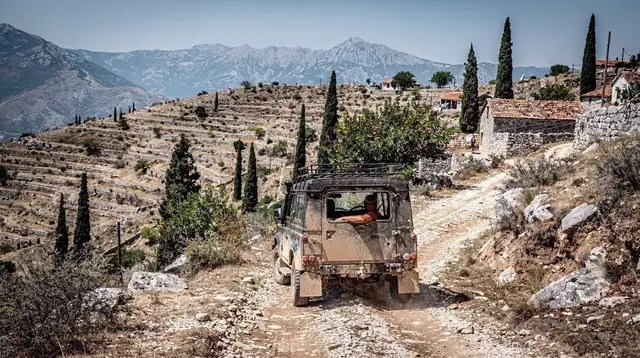
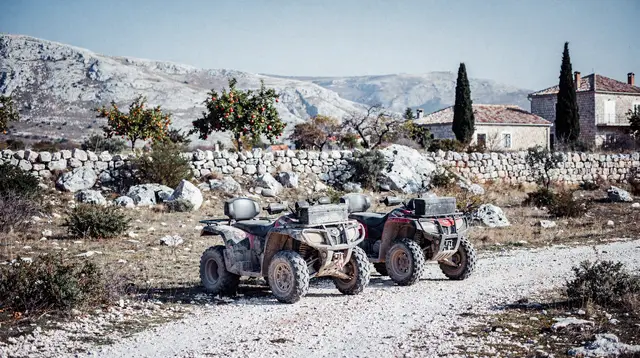
If your interest in the massif is more about scenery and less about summiting, an off-road jeep safari or a quad and buggy tour through the foothills can deliver a genuine taste of the terrain — the pine forests, the karst sinkholes, the sudden views back down to the Neretva — without the elevation gain or the navigation risk of the walking routes above. None of these substitute for the hike itself if a summit is the goal, but they’re a legitimate way to see the lower slopes on a day when weather or fitness rules out the ridge.
The trail network on Blidinje
Blidinje’s marked paths radiate from the lake and the small settlements around it. The lakeside and pasture trails are gentle, well-signed, and make a good half-day or full-day walk with wide views across the plateau to the surrounding peaks — good territory for a hiker who wants mountain scenery without technical difficulty. From there, routes climb toward Cvrsnica’s ridge and its karst formations, including areas known for striking rock pillars; these routes are longer, steeper, and exposed in places, and waymarking gets sparser above the pastures. Anyone heading up onto the ridge should treat it as a full mountain day: start early, watch the weather, and carry more water and layers than the valley temperature suggests you’ll need.
Blidinje also has a modest winter sports infrastructure, a reminder of just how different its climate is from the Mostar basin barely 90 minutes’ drive away — see the cold season around Mostar for how sharply the lowland and highland climates diverge in the same small region.
What lives up here: wildlife and the karst underfoot
The plateau and ridgelines feel empty compared with the busy valley towns, but the massif supports more life than the bare limestone suggests at first glance. Birds of prey circle the ridge thermals in summer, and the pastures around Blidinje’s lake draw a different set of species than the wetlands further south — see birds and cave wildlife in Herzegovina for what to watch for, and how it compares to the very different habitat at Hutovo Blato or the cave systems near Vjetrenica down toward the coast.
The broader picture of the region’s ecology, from the high pastures to the river wetlands, is in wildlife and wetlands of Herzegovina.
The ground itself is worth understanding too. This is classic karst — porous limestone riddled with sinkholes, dry valleys, and underground drainage — which is exactly why surface water disappears the way it does once you’re above the valley floor. It’s the same geology that produces Kravice waterfall and the travertine terraces further south, just expressed here as bare rock and scree rather than water and greenery. Walking off the marked path to get a better photo of a sinkhole or a rock formation isn’t just a landmine risk in places — it can also mean stepping onto ground that’s far less stable than it looks.
The route up Prenj
The standard approach to Prenj’s high ridge starts from the Zeleni Vir area and climbs through forest before breaking onto open limestone slopes. It’s a long ascent with real elevation gain, finishing on terrain that turns to loose scree and exposed rock near the ridgeline — not a walk to attempt in trail runners or without trekking poles. Weather changes fast at this altitude; a clear morning in the valley is no guarantee of a clear afternoon on the ridge, and cloud can drop visibility to a few metres with little warning.
Because of the distance and the terrain, many hikers split the route over two days, using one of the huts on the massif as a base rather than pushing for the summit and back in a single very long day. This also gives more margin against afternoon weather, which tends to build through the day in summer. If you’re inexperienced with alpine terrain, or attempting the mountain outside the core summer window, hiring a local guide through a Mostar or Konjic-based operator is a sound decision rather than an overcautious one — Prenj has claimed serious incidents from parties who underestimated it.
Snow, season, and the trap that catches visitors
This is the single most important practical point on this page, and it’s worth repeating because it runs against what most visitors expect after a few days in Mostar. Down in the Neretva basin, summer arrives early and stays brutal — see the summer heat in Mostar for just how extreme it gets, with days over 40°C. Blidinje and Prenj sit at a completely different altitude and climate.
Shaded gullies and north faces on Prenj can hold snow into June in a heavy winter, and the massif sees real winter conditions — snow cover, avalanche risk on steep slopes, and closed access roads — from roughly November through April. A hiker who packs for Mostar’s heat and then drives up to Prenj in May without checking conditions can find themselves on snow and ice with summer clothing and no traction aids.
Before any spring attempt, check conditions with a local mountaineering club (planinarsko drustvo) or a Mostar-based guiding operator rather than assuming the trail is clear because it’s warm in the valley. For general seasonal planning across the region, when to visit Mostar month by month covers the lowland calendar, but treat the mountains as running roughly six to eight weeks behind it at each end of the season.
| Zone | Typical snow-free window | Character |
|---|---|---|
| Blidinje lake & pastures | Late April – October | Gentle, marked, family-manageable |
| Blidinje / Cvrsnica ridge | Late May – September | Exposed karst, route-finding needed |
| Prenj lower approach (forest) | May – October | Long, steady climb, well used |
| Prenj summit ridge | Late June – September (variable) | Alpine terrain, scree, real exposure |
Treat these as rough guides, not guarantees — a late or heavy winter can push the safe window back by weeks in any given year.
Packing for altitude, not for the valley
The general hiking packing list for Herzegovina covers the baseline gear and the mine-safety rule that applies everywhere in the region, but a few items deserve extra emphasis specifically for Blidinje and Prenj rather than a standard day walk near Blagaj or Pocitelj. Layers matter more here than almost anywhere else on a Herzegovina itinerary: a still, warm morning at the trailhead can give way to a cold, wind-driven cloud bank on the ridge within an hour, and there’s no shop or shelter to retreat to if you’ve packed light. A synthetic or down mid-layer, a proper waterproof shell, and a hat and gloves are worth carrying even in July, tucked at the bottom of the pack on the days you don’t expect to need them.
Footwear is the other place people underestimate the terrain. Trail runners are fine on Blidinje’s lakeside paths but a poor choice on Prenj’s scree slopes, where ankle support and a stiffer sole make a real difference to both safety and pace. If you’re combining this trip with lower-key activities elsewhere in the region — cycling the valley floor, for instance, as covered in cycling Mostar and the Neretva valley — pack the mountain boots separately and don’t assume one pair of shoes can do both jobs well.
Mountain huts and where to stay
Both massifs are served by huts run by local hiking clubs rather than commercial hotels. On Prenj, the traditional base is around Zeleni Vir; on Blidinje, huts and simple accommodation cluster near the lake. Opening dates depend on the season and on volunteer staffing, so contact the managing club ahead of time rather than turning up expecting a bed — in shoulder season a hut may be locked, with only the emergency bivouac space (if any) accessible. Camping is possible in places but should stick to established, low-impact sites near existing huts rather than pitching at random on the plateau.
If a two-day traverse doesn’t fit your schedule, basing yourself in Konjic or Jablanica puts you within reach of the Prenj approach roads and lets you do a long single-day route instead, returning to a normal bed each night.
Lower-key alternatives if the mountain doesn’t fit your trip
Not every visitor to the region wants, or has time for, a full mountain day, and there’s no shame in choosing a gentler way to spend a day near these peaks instead. Boracko Lake, tucked into the valley below the Prenj foothills, offers flat walking, swimming in summer, and views up toward the massif without any of the elevation gain — a reasonable stand-in if the weather forecast for the ridge looks poor on the day you’d set aside for it.
Families traveling with children, in particular, should weigh the age limits for family adventure sports before committing to anything beyond the Blidinje lakeside paths; the itinerary for Mostar with kids leans toward exactly this kind of lower-intensity day.
The valley below the massif also has its own outdoor activities that don’t require mountain fitness. Rafting the Neretva, kayaking on the Neretva and Buna rivers, and canyoning in the Neretva gorges all deliver a full day of adventure activity at valley altitude, with none of the altitude-related planning this guide spends so much time on. For a lot of travelers, one of these makes a better second adventure day than a repeat mountain outing, especially outside the safe summit window on Prenj.
Combining the mountains with the valley below
Most visitors who make it up to Prenj are already spending time in the Neretva valley for other reasons — rafting, the wartime history around Jablanica and Konjic, or Tito’s underground bunker near Konjic. If you want to pair a shorter mountain walk with valley-based activities rather than a dedicated multi-day hiking trip, a day exploring Jablanicko Lake and Konjic works well as a lower-intensity alternative, and the day trip to Jablaničko Lake and Konjic covers the lake, the town, and nearby sights without requiring mountain fitness.
Those drawn more to the area’s Yugoslav-era history than to the ridge itself might prefer the tour of Tito’s bunker in the Neretva canyon near Konjic, which sits at the foot of the same mountains without the climb.
For hikers who want to understand the canyon terrain at valley level before or after a mountain day, the trails through the Neretva canyon near Jablanica cover gentler ground, and via ferrata routes near Mostar rounds out the region’s other fixed-line and scrambling options if Prenjska Vrata leaves you wanting more. Don’t confuse the region’s two very different conflicts while you’re reading up on the area’s history — the Battle of the Neretva in 1943 versus the 1992–1995 war explains which sites relate to which period, since Konjic and Jablanica both carry monuments to each.
Staying connected and paying your way once you’re out here
Once you’re up on the plateau or the ridge, you’re well outside the zone where a Mostar SIM card or Wi-Fi habit will help you. Sort out connectivity before you leave the valley — see SIM cards and internet in Bosnia — and download any maps or GPS tracks in advance rather than assuming you’ll be able to pull them up at the trailhead. The same applies to cash: the huts and the small shops in villages near the trailheads are unlikely to take cards, so carry what money and currency in Bosnia recommends for a rural day, and check tipping in Bosnia and Herzegovina if you’re using a hut, a guide, or a driver for the day.
Food is worth planning around too. There’s no equivalent up here of grabbing cevapi or burek at a stand in Mostar’s old town — huts serve simple, limited menus when they’re staffed at all, and outside those hours you’re carrying everything you eat. Stock up in Konjic or Jablanica before heading up, and save the sit-down meal — and a glass of the region’s rakija if you’ve earned it — for back down in the valley once the day is done.
Gear and safety notes specific to altitude
Beyond the general rural mine-safety rule covered elsewhere — stay on marked paths, don’t cross open or forested ground off-trail — a handful of points are specific to hiking at this altitude:
- Water is scarcer than the map suggests. Karst terrain drains fast, and springs marked on older maps can run dry by midsummer. Carry everything you expect to drink for the day.
- Weather turns quickly. Cloud and wind build through the afternoon in summer; start early and have a turnaround time in mind before you set off, not after you’re already committed to the ridge.
- Phone signal is unreliable above the lower slopes on both massifs. Tell someone your planned route and expected return time before you start.
- Trekking poles and proper boots matter more here than on the lowland trails around Mostar — the ground near the ridges is loose scree and exposed rock rather than packed dirt.
- Snow gear (microspikes at minimum) should be considered for any attempt before late June, even if the forecast in the valley looks like full summer.
Fitting this into a longer Herzegovina trip
A mountain day on Blidinje or Prenj is a poor fit for a rushed itinerary, so think about where it sits in the bigger picture before you commit to it. Travelers working with three days in Mostar or the Mostar and Herzegovina in three days framework generally shouldn’t try to squeeze a full Prenj summit attempt into that window at all — it competes too directly with the old town, Blagaj, and Kravice for the one or two days you actually have free, and a rushed mountain day is exactly how people end up caught by afternoon weather. A one-week trip through Bosnia and Herzegovina has far more room to dedicate a full, unhurried day — or two, with a hut night — to the mountains without shortchanging everything else on the list.
If Sarajevo is also on your route, note that the drive between Mostar and the capital passes reasonably close to these massifs, and some travelers use that leg of the journey to build in a stop rather than treating the mountains as a separate side trip entirely — worth checking against whichever version of the route to Sarajevo you’re planning to take.
Planning your trip
If Prenj or Blidinje is one stop on a broader itinerary rather than the whole point of the trip, the Herzegovina road trip itinerary and the Neretva nature itinerary both sketch out ways to combine a mountain day with the region’s rivers, canyons, and towns without over-committing your schedule. Whichever route you choose, treat the mountain day as its own commitment: an early start, a real weather check, and enough daylight margin to turn back if conditions on the ridge don’t match what you saw from the valley floor that morning.
Hiking and nature walks on GetYourGuide
Verified deep-linked GetYourGuide tours. Book through these links and we earn a small commission at no cost to you.
GetYourGuide does not provide a product photo for this activity — the image shows the meeting point, photographed by us.