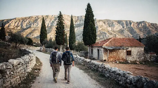
Herzegovina’s postcard image is low, dry, and white with limestone — Mostar’s old town, the Kravice waterfalls, the sunburnt hills around Medjugorje. Blidinje and Prenj are a different country stacked on top of that one: a high karst plateau and the jagged massif beside it, rising north of Mostar toward Konjic and Jablanica, where winter actually means snow rather than a mild dip in temperature.
A Mountain Region Unlike the Rest of Herzegovina
Most of Herzegovina sits low enough, and close enough to the Adriatic, that snow is a curiosity rather than a season. Mostar barely sees it. Blidinje and Prenj are the exception that proves the rule. Blidinje Nature Park is a broad upland basin of grassland, pine forest, and a shallow seasonal lake, sitting at an elevation where winter genuinely bites. Mount Prenj rises beside it as one of Bosnia and Herzegovina’s most serious limestone massifs, a jumble of ridges, gullies, and exposed rock that draws climbers and trekkers rather than casual walkers.
The contrast with the coast-facing lowlands matters for planning. A trip built around the Neretva canyon or a wine afternoon near Mostar assumes short sleeves and dust. A trip up here assumes layers, a real jacket, and — depending on the month — genuine winter kit. Checking when to come to Mostar month by month is worth doing before you commit to dates, because the calendar that suits the old town and the calendar that suits this high country don’t overlap as neatly as visitors expect.
Getting Here: Konjic and Jablanica as Gateways
Neither Blidinje nor Prenj has a town of its own in the usual sense — you reach them through Konjic or Jablanica, the two settlements that anchor this stretch of the Neretva canyon on the road and rail line between Mostar and Sarajevo. Both towns are covered in their own right elsewhere on this site; here, the focus stays on the mountains themselves and what it takes to get up into them.
From Mostar, the drive runs north along the Neretva valley before turning off toward the highlands, and the last stretch climbs steadily onto the plateau. Figure on an hour and a half to two hours from Mostar to Blidinje under normal summer conditions, more if you’re continuing up toward Prenj’s higher trailheads.
There’s no meaningful public transport option for the final approach — buses and the Mostar–Sarajevo train will get you to Konjic or Jablanica, but the mountain itself needs a car, a transfer, or a guide with a vehicle. If you’re weighing whether to rent a car or book an organized excursion for the wider trip, this is one of the clearer arguments for having your own wheels, or at least a driver, once you’re this far from Mostar.
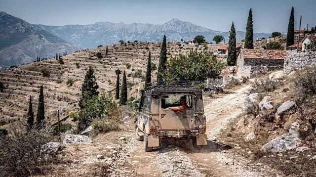
Road surfaces are adequate but noticeably rougher than the main highway corridor — expect gravel sections, switchbacks, and limited signage compared to what you’ll have gotten used to around the city. A capable standard car manages the main routes in dry weather; a 4x4 with winter tyres becomes the sensible choice from late autumn through spring, and mandatory on some of the higher approach tracks once snow settles in.
What Blidinje Actually Is
Think of Blidinje less as a single sight and more as a landscape you move through. The plateau spreads out in open meadow and scattered pine, framed by mountains on every side, with a shallow lake that expands and contracts with the season. Walking routes here range from easy strolls suited to most fitness levels to longer day hikes that climb toward the ridgelines separating Blidinje from Prenj proper.
It’s also the region’s winter sports ground, in a modest, low-key sense rather than an Alpine-resort one. Snow holds reliably from December into March, and the plateau is used for cross-country and ski-touring routes rather than lift-served downhill runs on any large scale. This is a destination for visitors who already have some winter mountain experience, or who go with a local guide rather than showing up expecting rental gear and marked pistes at every turn.
a guided day trip from Sarajevo that takes in Jablaničko Lake and Konjic gives a useful sense of the wider region if you’re approaching from the Sarajevo side rather than from Mostar, since it covers the same access corridor these mountains sit above.
Mount Prenj: The Serious Side of the Range
If Blidinje is the approachable half of this landscape, Prenj is the demanding one. It’s a proper limestone massif — steep, exposed, cut by deep gullies, with routes that require real trekking fitness, sturdy boots, and, for anything beyond the most established paths, a guide who knows the terrain. This isn’t a mountain to improvise on with a map glanced at over breakfast.
Climbers and canyon-country enthusiasts based around Konjic and Jablanica sometimes treat Prenj as an extension of the same trip that brings them to the Neretva canyon’s via ferrata routes or the canyon’s climbing terrain more broadly.
If you’re equipping yourself rather than bringing everything from home, renting climbing gear locally for the Neretva canyon area is a practical shortcut, and a guided via ferrata outing such as the Prenjska Vrata via ferrata adventure tour out of Jablanica is a reasonable way to get a taste of the massif’s character without committing to a full multi-day expedition on your first visit.
For anyone building a longer trekking itinerary, this is also the point where the region connects to Herzegovina’s broader outdoor scene. A dedicated hiking guide to Blidinje and Prenj covers route options in more depth than fits here, and it’s worth reading alongside a general hiking checklist for Herzegovina before you set out, since gear needs at this elevation differ meaningfully from a lowland walk near Blagaj or Počitelj.
The Rule That Matters Most Up Here: Stay on the Marked Paths
This is the one point worth repeating without softening it. Bosnia and Herzegovina still has an estimated 1.6% of its territory listed as suspected to contain landmines and unexploded ordnance left over from the 1992–1995 war, concentrated in rural, forested, and mountainous terrain rather than in towns, on paved roads, or on established, waymarked trails. Blidinje and Prenj are precisely the kind of remote upland terrain where this history hasn’t fully receded.
In practice, this changes almost nothing about a sensibly planned visit. The park’s marked trails, huts, and the routes covered by local guides and hiking literature are cleared and used safely by hikers every season. The risk sits off those paths — cutting across an unmarked meadow to shortcut a bend, wandering into treeline away from a known route, poking around an abandoned structure out of curiosity.
The rule is simple and non-negotiable: stay on marked and waymarked trails, don’t cut through untracked fields or forest in this kind of remote countryside, and if you see a skull-and-crossbones warning sign or anything that looks like old ordnance, don’t approach or touch it — just note the location and move on. A full guide to safety and landmines in rural Bosnia and Herzegovina covers this in more detail and is worth reading before any hike in this region, not just this one.
Seasons: Two Very Different Mountains in One Year
| Season | What it looks like | Who it suits |
|---|---|---|
| June–September | Green plateau, wildflowers, long daylight, marked trails clear and dry | Hikers, day-trippers, photographers, first-time visitors |
| October–November | Cooling fast, early snow possible at altitude, fewer facilities open | Experienced hikers comfortable with shoulder-season uncertainty |
| December–March | Snow-covered plateau, ski touring and cross-country conditions | Winter sports visitors, guided groups, experienced mountain travelers |
| April–May | Snowmelt, muddy trails, unpredictable conditions | Flexible travelers willing to check conditions locally first |
The contrast with the rest of Herzegovina is worth internalizing before you pack. While Mostar in winter means a quiet, mild off-season with the odd cold snap, Blidinje in the same month can be genuinely snowbound. Pack, and plan, for the mountain you’re actually visiting rather than the city you started from.
A Practical Day or Two
For a single-day visit, the realistic pattern is: leave Mostar early, drive the roughly ninety minutes to two hours up through Konjic or Jablanica, spend the bulk of the day walking one of Blidinje’s marked routes or taking in the plateau’s viewpoints, and drive back before dark — mountain roads without street lighting are not where you want to be improvising a return route after dusk. Fuel up before you leave the main road corridor, since facilities thin out fast once you’re on the plateau, and carry more water and layers than you think you’ll need; conditions change quickly at this elevation even in summer.
For anything more ambitious — a multi-day trek toward Prenj’s higher routes, a proper ski-touring trip, or a combined outing that also takes in the wider Neretva canyon’s nature and rivers — plan on basing yourself in Konjic or Jablanica for at least one night rather than pushing there and back from Mostar in a single day.
It’s also worth deciding early whether you’re building this into a longer loop; travelers stitching together a full week-long trip across Bosnia and Herzegovina or a broader Herzegovina road trip often slot Blidinje and Prenj in as the mountain counterweight to a week otherwise spent in river valleys and old towns.
If a guide is doing the driving and route-finding for you, a guided tour connecting Mostar with the river valleys and mountains north of the city is a reasonable way to see the transition between lowland Herzegovina and this high country without managing the logistics yourself.
What to Pack
Regardless of season, this is not a trip to arrive at underprepared. Sturdy, broken-in hiking boots matter more here than almost anywhere else covered on this site — the terrain is rockier and less forgiving than the paved courtyards of Mostar’s old town or the gravel paths at Kravice. Bring layers you can add and remove as elevation and weather shift through the day, more water than a lowland hike would require, and a paper map or downloaded offline map, since mobile signal thins out fast once you’re off the main roads. In winter, that list extends to proper winter boots, insulated layers, and — for anything beyond the most basic plateau walking — avalanche awareness or a local guide.
Blidinje and Prenj FAQ
Is Blidinje a good day trip from Mostar?
It can be done in a long day if you have a car, but the driving alone takes three to four hours round trip on mountain roads, which leaves only a few hours on the plateau. Most visitors who want more than a quick look treat it as an overnight or add it to a wider loop through Jablanica and Konjic.
Do I need a 4x4 to reach Blidinje?
A standard car manages the main approach roads in dry summer conditions, though the surface is rougher than the highways around Mostar. In winter or after heavy rain, a higher-clearance vehicle and winter tyres make a real difference, and some side tracks are best left to 4x4s.
Are there landmines in Blidinje and Prenj?
Bosnia and Herzegovina still has roughly 1.6% of its territory listed as suspected mine-affected land, mostly in remote rural, forest, and mountain areas from the 1992–1995 war — and this high country is exactly that kind of terrain. Marked trails, huts, and the park’s established routes are cleared and safe; the risk is off-trail, in unmarked forest and pasture, not on the paths hikers actually use.
Can you ski at Blidinje?
Blidinje’s plateau holds snow reliably from December through March and is used for ski touring and cross-country skiing rather than lift-served downhill resorts on the scale of the Alps. It’s a destination for people who already have winter mountain experience or who go with a local guide, not a casual ski holiday.
How does Prenj compare to Blidinje for hiking?
Blidinje is the gentler, plateau-like part of the region — meadows, a shallow lake, marked walking routes suited to a broad range of fitness levels. Prenj is the massif proper: steeper limestone terrain, longer approaches, and routes that call for real trekking experience, sturdy footwear, and, ideally, a guide or a well-prepared group.
Where do I base myself to visit this area?
Konjic and Jablanica are the two access towns for the region and both sit on the main road and rail corridor between Mostar and Sarajevo, making them the practical places to stay, refuel, and pick up local advice before heading up into the mountains.
Is this trip suitable without a car?
It’s difficult. Blidinje and Prenj have no public transport network to speak of, and the approach roads from Konjic and Jablanica are not realistically walkable as an access route. A rental car, a private transfer, or a guided tour with transport included are the workable options.