Are There Still Landmines in Herzegovina?
I get asked this question quietly, usually after someone has already booked their flight. Never on the group chat, never in a review — just a message that starts with “this might be a strange question” and ends with “landmines.” It isn’t a strange question. It’s a smart one, and most guidebooks dodge it because it’s uncomfortable. I’d rather just answer it straight.
The number, and what it actually means
Roughly 1.6% of Bosnia and Herzegovina’s total land area is still classified as suspected hazardous area — land that may contain mines or unexploded ordnance left over from the 1992-1995 war. That figure comes up in every serious account of the country’s post-war landscape, and it’s real. I’m not going to soften it or pretend the war left nothing behind.
But a percentage without a map is meaningless, and this is where most people’s imagination runs ahead of the facts. That 1.6% isn’t scattered evenly across the country like a light dusting of risk over every field, path, and parking lot. It’s concentrated in specific, mapped, largely rural categories of land: forest, scrubland, mountainside, abandoned agricultural plots, former confrontation lines that were never resettled. It is not concentrated in the places tourists actually go.
Where the risk isn’t
I want to be very direct about this part, because it’s the part that actually matters for your trip. Mostar’s streets carry no mine risk. The Stari Most, Kujundziluk, the old town, the Bulevar, every paved road you’ll drive on between towns — none of it. The tourist sites that fill every itinerary of this region — Kravice, Blagaj and its tekija, Pocitelj, the vineyards around Citluk, Medjugorje — are established, heavily trafficked attractions that have been checked and are safe. Hundreds of thousands of visitors walk through these places every year. If there were any residual risk at a site like Kravice or Blagaj, it would not still be operating as a paid tourist attraction.
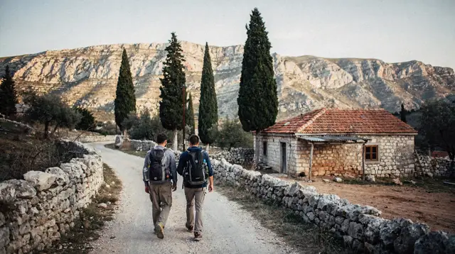
The same goes for marked hiking. If a trail is signed, maintained, and appears in a hiking guide or on a park map — around Blidinje and Mount Prenj, for instance, or along the canyon routes near Jablanica — it has been walked by enough people, for long enough, that it is considered safe ground. Marked trails get maintained precisely because people use them; unmarked ground doesn’t get that scrutiny.
Where the risk actually is
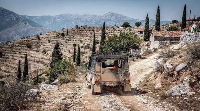
The honest picture is narrower and more specific than “the countryside is dangerous.” The suspected areas cluster in unmarked rural and forested land — old confrontation lines, abandoned farmland that was never fully resettled after the war, dense forest and remote mountainside away from any signed route. This is land that nobody has systematically walked, checked, or had reason to clear, because nobody lives there or farms it anymore.
Practically, that means the risk shows up if you decide to leave a marked trail and cut across a field, if you wander into forest that isn’t part of a signed route, or if you go looking for an abandoned building or bunker off any established path out of curiosity. It’s not a risk that ambushes you on a day trip built around Kravice, Blagaj, and Pocitelj, or on a rafting run down the Neretva with a licensed operator. It’s a risk tied to a specific choice: going off-trail in remote rural terrain.
I think the reason this question makes people anxious is that “landmine” sounds absolute and invisible, so the natural response is to want to avoid the entire country. But the actual rule is narrower and, honestly, easier to follow than that: stay on marked paths, stay off unmarked rural land, and you’re not making decisions any different from hiking in most mountainous countries with a complicated 20th century.
What the warnings actually look like
If you do end up near a suspected area — which, again, is not something a normal itinerary puts you near — the signage is usually a red metal or plastic sign with a skull-and-crossbones symbol, sometimes paired with red-and-white tape marking a boundary line. Bosnian text often accompanies the symbol, but the symbol itself is the part to recognize. Treat it as absolute. Don’t approach it for a photo, don’t step past it to “just look,” and don’t assume a sign that looks old or faded is out of date. These signs don’t expire.
If you ever come across something on the ground that looks like it might be ordnance — corroded metal, an odd shape half-buried, anything that gives you pause — the instructions are the same everywhere in the world: don’t touch it, don’t move it, don’t stand over it for a photo. Note where you are, walk back the way you came, and tell your guide, your accommodation, or the police. This applies whether you’re on a guided hike, driving a rental car, or wandering with a rafting group.
How I’d actually plan around this
For most travelers, this question resolves itself the moment you look at what you’re actually doing in Herzegovina: visiting the old town, touring Blagaj and Pocitelj, tasting Zilavka and Blatina, floating down the Neretva, walking a signed trail near Konjic or through Blidinje and Prenj. None of that touches the 1.6%. Where it becomes relevant is if you’re the kind of traveler who likes to improvise — pull the car over, walk toward an abandoned building, follow a goat path that isn’t on any map. That’s the moment to stop and stick to something signed instead.
If you want structure rather than improvisation, a guided day out removes the question entirely — someone else is choosing the ground, and it’s ground they’ve walked before. A Herzegovina waterfall day tour from Mostar or a guided day trip to Boracko Lake keeps you on established routes by default. If you’d rather set your own pace with a driver who still knows exactly where to stop, a private Herzegovina tour built around the waterfalls gets you the same reassurance with more flexibility.
Before any hike that takes you further off the beaten track — Blidinje, Prenj, the trails around the canyon — it’s worth reading through our guide to landmine safety in rural Herzegovina and this hiking packing list for Herzegovina, both of which go into the practical side of staying on safe ground.
If a specific hike is on your list, hiking Blidinje and Mount Prenj and the Neretva canyon trails near Jablanica cover the marked routes in detail, and via ferrata near Mostar and canyoning in the Neretva gorges do the same for the more adventurous options around the Neretva.
If you want the fuller picture of what shaped this landscape in the first place, the Bosnian war in Mostar is the place to start, and our Neretva nature itinerary shows how a nature-focused route through the region is built to stay entirely on established ground.
The short version, if you only take one thing from this: the danger is real but narrow, it’s rural and unmarked, and every place you were already planning to visit — Pocitelj, Blagaj, Kravice, the trails around Konjic and Jablanica — sits outside it. Stay on the path. That’s really the whole rule.
Wine tasting and winery tours on GetYourGuide
Verified deep-linked GetYourGuide tours. Book through these links and we earn a small commission at no cost to you.
GetYourGuide does not provide a product photo for this activity — the image shows the meeting point, photographed by us.