The Avenue That Still Divides Mostar
I got this wrong myself the first time, so I don’t think less of anyone who assumes the same thing. You stand on the Stari Most, you look down at the Neretva splitting the old town into two riverbanks, and it feels obvious: this must be where the city broke apart during the war. It isn’t. The line that actually divided Mostar during the 1992-1995 war runs nowhere near the river. It runs along the Bulevar, an avenue that cuts through the city on a roughly east-west axis, more or less perpendicular to the Neretva.
I want to walk through why that distinction matters, because it changes what you’re actually looking at when you visit, and it corrects a story that gets repeated on a lot of tour buses without much scrutiny.
The river you see is not the line you’re looking for
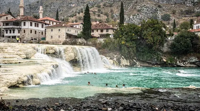
The Neretva is the river that makes Mostar photogenic. It’s what the Stari Most spans, what the old bazaar of Kujundziluk sits beside, and what gives the city its postcard shot from the bridge. Standing at the old bridge, with the two banks of the old town facing each other across the water, it is tempting to read the river itself as a boundary between two communities.
But the war didn’t split Mostar along its river. It split the city along the Bulevar, the avenue running through the newer, wider part of town, well north and west of the historic core around the Stari Most. If you walk the tourist route through the old town, down toward the bridge and back, there’s a real chance you’ll never cross it at all. It sits outside the loop that most short visits actually cover.
I think the confusion is understandable rather than careless. Mostar genuinely does present itself as a city of two banks, and the war genuinely did produce two sides in the city’s memory and administration. It’s just that the geography doesn’t line up the way the river suggests it should. The dividing axis runs perpendicular to the Neretva, not along it.
What the Bulevar actually was
During the 1992-1995 war, the Bulevar became the confrontation line between the warring factions inside the city. It is not a symbolic axis retrofitted onto the map after the fact - it was the literal frontline, the street where positions were held and buildings were fought over for months. That’s also why, if you go looking for it, you’ll find it carries some of the heaviest visible scarring left in Mostar: facades pocked by small-arms fire, buildings that were gutted by shelling and never fully rebuilt, standing today alongside ordinary shopfronts and passing traffic.
That contrast is part of what makes the avenue worth understanding even if you don’t plan to walk its full length. It is a working street in a working city - buses, cafés, people going about the day - with damage from thirty-odd years ago still legible on some of its buildings if you know to look up.
I’d put this in the same category as the war-damaged buildings elsewhere in the city: visible, but not curated as a memorial. Nobody has turned the Bulevar into a museum piece. It’s simply been left standing, doing its job as a road, while carrying its history on its surface.
Why the line still matters today
Here’s the part that surprised me more than the geography itself: this isn’t only a historical detail. Mostar has, for a long time, run separate school and municipal structures on either side of roughly that same axis - not a wall, not a checkpoint, nothing you’d photograph, but a real administrative split that has outlasted the ceasefire by decades. I don’t think it’s honest to describe Mostar to a visitor as a “reunified” city in any simple sense, and I also don’t think it’s honest to treat the war as background noise that has nothing to do with how the city functions now. Both framings flatten something that’s genuinely more complicated.
For a short visit, none of this needs to dominate your day. But if you’re the kind of traveler who wants the actual shape of a place rather than the postcard version, it’s worth holding onto: two banks of a river is a description of geography, not of history. The line that mattered here ran a different way entirely.
What this piece isn’t about
I’ve kept this deliberately narrow, because two related questions deserve their own space rather than a rushed paragraph here. Whether and how you should visit sites connected to the war - what’s appropriate to photograph, what reads as memorial versus spectacle - is its own question, and I’ve written about it separately in a piece on visiting a still-divided city.
And if you’re specifically interested in the Partisan Cemetery, the memorial complex not far from here that commemorates an earlier conflict, that has its own dedicated page too - it’s a different site with a different history than the Bulevar, even though the two sit within walking distance of each other and get conflated more often than you’d expect.
If you want the fuller picture of the 1992-1995 war in Mostar, including how it differs from the much earlier Battle of the Neretva in 1943, I’d start with a broader explainer on the war itself and this piece on not confusing the two conflicts, since visitors mix them up constantly and the details genuinely aren’t interchangeable.
Seeing it for yourself
If you do want to see the Bulevar rather than just read about it, it takes maybe twenty to thirty minutes on foot from the old town, and it isn’t marked with plaques or arrows - it just looks like an ordinary boulevard until you start noticing the buildings. A few practical notes if you go looking:
| What you’re checking for | Where to look |
|---|---|
| Bullet-scarred facades | Building fronts facing the avenue itself, particularly older apartment blocks |
| Shelled, unrepaired structures | Set back slightly from the road, mixed in with renovated buildings |
| Contrast with the old town | Walk from the Bulevar toward the Stari Most and notice how quickly the damage thins out |
For more context before or after, a guided walk through Mostar’s old town will usually mention the Bulevar even if it doesn’t walk you along it, and a war memory itinerary or a browse through the site’s war history category will place it alongside the other sites - the Partisan Cemetery, the museums, the memorials - that together tell a fuller version of the story than any single street can.
If you’d rather have someone walk you through that context in person rather than piecing it together yourself, a guided day trip through Mostar’s old town and its war history usually covers this ground without you having to plan the route.
If you’d rather get the wider view of the city first, Hum Hill gives you an elevated look at how the newer avenue and the old riverside core actually relate to each other, which helped me more than any map did. Several of the wider Herzegovina day trips, like this full-day Mostar and Herzegovina tour, build in enough free time in the old town to walk out toward the Bulevar on your own before or after the scheduled stops.
None of this needs to change your itinerary. But the next time someone tells you Mostar was split by its river, you’ll know that’s the postcard talking, not the history.
Wildlife and nature tours on GetYourGuide
Verified deep-linked GetYourGuide tours. Book through these links and we earn a small commission at no cost to you.
GetYourGuide does not provide a product photo for this activity — the image shows the meeting point, photographed by us.